SUMMIT LAND SURVEYORS

Summit Land Surveyors
INNOVATIVE SURVEYING SOLUTIONS

SERVING PORTLAND AND NORTHWEST OREGON
Our mission is to exceed our clients expectation of value and service by providing prompt, accurate, and efficient surveying and consulting services.

SURVEYING SERVICES


PRE-DESIGN SURVEYS


LEGAL DESCRIPTIONS


TOPOGRAPHIC SURVEYS


SUBDIVISION / PARTITION PLATTING


MORTGAGE SURVEYS


CONSTRUCTION SURVEYS


PROPERTY LINE ADJUSTMENTS


BOUNDARY SURVEYS


FEMA ELEVATION CERTIFICATES


ALTA/NSPS LAND TITLE SURVEYS

Surveyor sighting through total station


OUR COMPANY


Surveyor Logo
Summit Land Surveyors is a surveying and consulting firm located near Portland, Oregon, in the Pacific Northwest. Our team has been assisting everyone from homeowners, real estate agents, and attorneys to insurance adjusters, contractors, architects and land developers in the Pacific Northwest for over 15 years. Our unparalleled service, competitive prices, and overall value are why our loyal customers won't go anywhere else.

Summit Land Surveyors was established by John Wade and Cory Montgomery in 2008. We are a small, full service surveying firm specializing in development surveying, working with both private and public clients on residential and commercial projects.

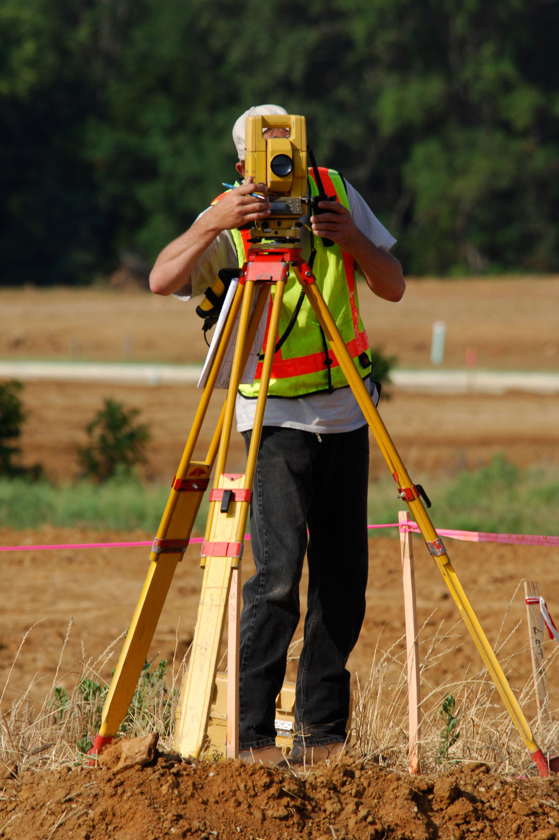
We limit our workload to assure each project of receiving the required effort needed to maintain its timeline and budget. We utilize the latest tools and technology which enable us to provide cost-effective and innovative surveying solutions for both large and small projects. We are able to maintain our high standard of surveying and mapping as well as customer service as a result of pro-active, hands-on participation of the owners on each and every project.

Having a knowledgeable and skilled survey group as part of the team is a key component to the success of a project. Our team is ready and able to provide an efficient, full service experience from field to finish.

SURVEY CREW


Surveyor sighting through total station and providing direction.
John Wade is a co-owner of Summit Land Surveyors, LLC. John has over 27 years combined field and office experience, and is a registered Professional Land Surveyor in Oregon.

John's career path has taken him from an entry level position as a field assistant all the way to becoming a partner and the Director of Surveying for a nationwide, multi-disciplined design firm. This experience has proven invaluable in providing a well rounded work experience and solid business education as the foundation for his role at Summit Land Surveyors. It also solidified his desire to shed the constraints and compartmentalization typically inherent in a large corporate bureaucracy. Being owner-operator of a small size, full service surveying firm enables us to maintain continuity of care throughout the life of a project assuring our clients the best possible service from field to finish.


Cory Montgomery is a co-owner of Summit Land Surveyors and has over 22 years of combined field and office experience in both surveying and engineering.

Cory's work experience has primarily been with large multi-disciplined firms. This has provided a solid understanding of both commercial and residential development / construction projects as well as the importance of good communication and proactive problem solving. Working directly with interdisciplinary team members while supervising survey field and office staff and has provided a unique perspective and understanding of essential components required for a successful project. This knowledge combined with his technical prowess and superior work ethic is the cornerstone on which Summit Land Surveyors is founded.

FREQUENTLY ASKED QUESTIONS


What does a Surveyor know that I may not?
Surveyors must have a thorough knowledge of algebra, basic calculus, geometry, and trigonometry. They must also know the laws that deal with surveys, property, and contracts. In addition, they must be able to use delicate instruments with accuracy and precision. In the United States, surveyors and civil engineers use units of feet wherein a survey foot is broken down into 10ths and 100ths. Many deed descriptions requiring distance calls are often expressed using these units (125.25 ft). On the subject of accuracy, surveyors are often held to a standard of one one-hundredth of a foot; about 1/8th inch. Calculation and mapping tolerances are much smaller wherein achieving near perfect closures are desired. Though tolerances such as this will vary from project to project, in the field and day to day usage beyond a 100th of a foot is often impractical. In most states of the U.S., surveying is recognized as a distinct profession apart from engineering. Licensing requirements vary by state, however these requirements generally all have a component of education, experience and examinations. In the past, experience gained through an apprenticeship, together with passing a series of state-administered examinations, was required to attain licensure. Nowadays, most states insist upon basic qualification of a Degree in Surveying in addition to experience and examination requirements. Typically the process for registration follows two phases. First, upon graduation, the candidate may be eligible to sit for the Fundamentals of Land Surveying exam, to be certified upon passing and meeting all other requirements as a Surveyor In Training (SIT). Upon being certified as an SIT, the candidate then needs to gain additional experience until he or she becomes eligible for the second phase, which typically consists of the Principles and Practice of Land Surveying exam along with a state-specific examination.

Typically a licensed land surveyor is required to sign and seal all plans, the format of which is dictated by their state jurisdiction, which shows their name and registration number. In many states, Oregon being one of them, when setting boundary corners land surveyors are also required to place monuments bearing their registration numbers, typically in the form of capped iron rods, concrete monuments, or nails with washers.
What kind of Equipment is used for surveying?
As late as the 1990s the basic tools used in planar surveying were a tape measure for determining shorter distances, a level for determine height or elevation differences, and a theodolite, set on a tripod, with which one can measure angles (horizontal and vertical), combined with triangulation. Starting from a position with known location and elevation, the distance and angles to the unknown point are measured. A more modern instrument is a total station, which is a theodolite with an electronic distance measurement device (EDM) and can also be used for leveling when set to the horizontal plane. Since their introduction, total stations have made the technological shift from being optical-mechanical devices to being fully electronic with an onboard computer and software. Modern top-of-the-line total stations no longer require a reflector or prism (used to return the light pulses used for distancing) to return distance measurements, are fully robotic, and can even e-mail point data to the office computer and connect to satellite positioning systems, such as a Global Positioning System (GPS).
How much will my survey cost?
Generally, it is difficult to provide an exact amount for the price of a survey. There are many variables that can affect the cost of a survey. Depending on the type of survey requested, we may have to coordinate with engineers, planners, title companies, and contractors just to name a few. We will likely have to research public records, contact title companies, and possibly interview local residents. We will make every attempt to provide you with an accurate estimate of the project, prior to beginning any work. However, since there is only so much we can anticipate up front, unforeseen circumstances can arise, which makes an exact price almost impossible. Remember when choosing a surveyor to ask exactly what they intend to do for you for the price they have quoted. If you are trying to compare fees, you need to know exactly what you are comparing.
Why should I have a title report?
There are many things disclosed in a title report, many of which do not pertain to surveying. However, a surveyor generally will want to see a title report because it will disclose any easements and property rights that may exist on the property. When we are surveying a property to define it’s boundary, or building space, we will require the vesting deeds for your property, as well as those of your neighbors. A single piece of property is like a puzzle, in that it fits in between other properties. In order to see how your property fits, we need to see how the neighbors fit as well. The deeds are a written document that describes your land. The title company will provide these deeds to us along with the title report so that we can properly resolve your boundary. These records are available at the county, however, only a title company has the tools to properly research and assemble all the deeds necessary to get a clear picture of your property and the easements that may exist on it. There is a fee associated with a title report from the title company, but using their tools and being their area of expertise, their fee is generally lower than if you attempt to do all the research on your own. There is also a guarantee that comes with that fee.
Will a surveyor tell me what property I own?
No. A surveyor uses the deed for your property to resolve your boundary, and give you their professional opinion of your ownership. However, if problems are discovered such as neighboring gaps or overlaps, structural or use encroachments, or other problems, the surveyor can assist you in resolving the conflicts. Typically, a conversation and cooperation with the neighbor to adjust the property line, or create an easement is all that is necessary. If that course of action is unsuccessful, the problem may need to be brought to a court of law. This action being the most expensive solution.

CONTACT US
SUMMIT LAND SURVEYORS, LLC
12930 SW PACIFIC HWY, SUITE 123
TIGARD, OR 97223
PH.
EMAIL:
For more information or to schedule a complimentary consultation, please send us an email or give us a call.
CALL
If you prefer to send us an email so we can provide you with a free online estimate of your project, please just give us a brief description of your project, along with a project address and either a phone number or email address where you can be reached. We pride ourselves in being service oriented, and will make every attempt to respond to your inquiry within the next business day.
SEND EMAIL